

Custom Routes Across Assam, Meghalaya & Arunachal
Private, driver-guided itineraries for the Shillong–Cherrapunjee road, Dawki river, and Arunachal peaks. Planned by local experts.
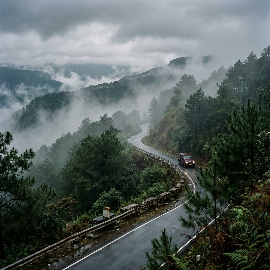
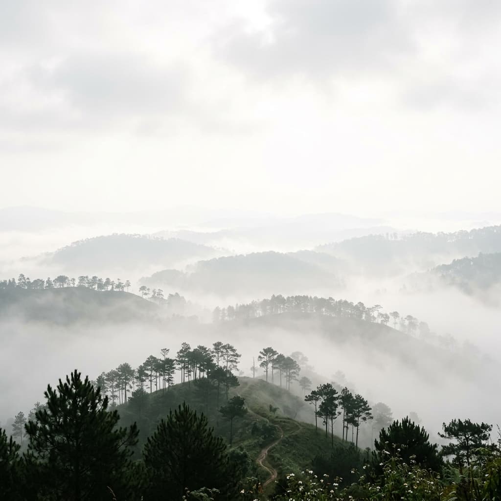
Log 04 — The winding road from Shillong to Cherrapunjee under monsoon fog.
Assam, Meghalaya & Arunachal Pradesh
We plan custom, driver-guided routes through Northeast India. Our focus is on raw terrain, local communities, and honest, detailed itineraries—designed by guides who know every curve of the hills.
Decades on the Road
Our network of local drivers has navigated the sharp hairpin curves and dense fog of the East Khasi Hills for decades.
Off-Beat Routes
We bypass commercial packages to route you through quiet villages like Nartiang, hidden falls, and local homestays.
Honest Timelines
No rushed tour templates. We calculate actual driving hours with built-in time for tea stalls and village walks.
Regional Coverage
From the grasslands of Kaziranga in Assam to the high snow-capped mountain passes of Tawang in Arunachal.
Featured Destinations
Select a curated state circuit below to view detailed day-by-day travel itineraries. All routes are fully customizable to your schedule.
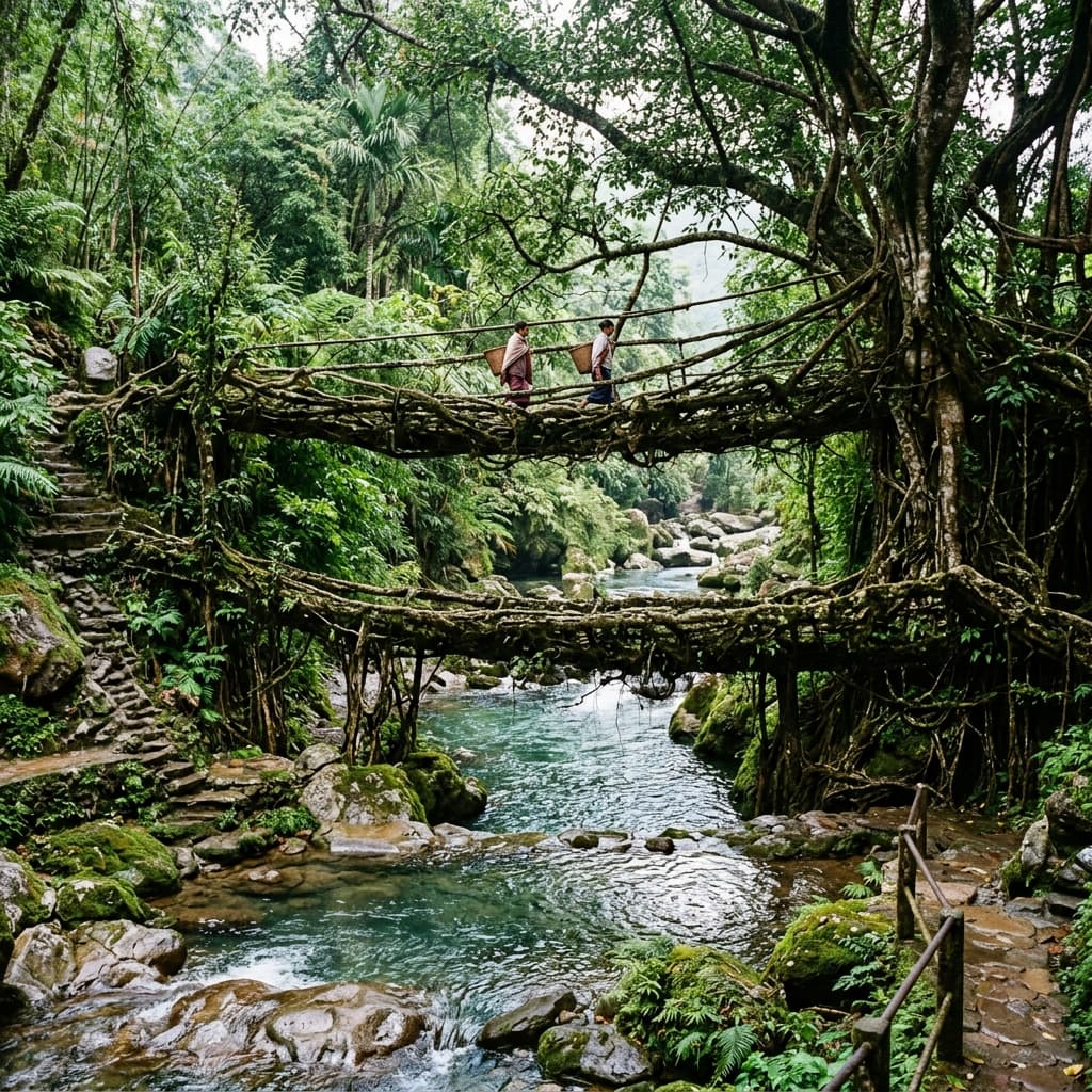
Meghalaya Highlands Circuit
Shillong, Cherrapunjee & Dawki
Canyons, caves & living root bridges

Assam Valley & Wildlife
Kaziranga & Brahmaputra Plains
Tea gardens & river island cultures
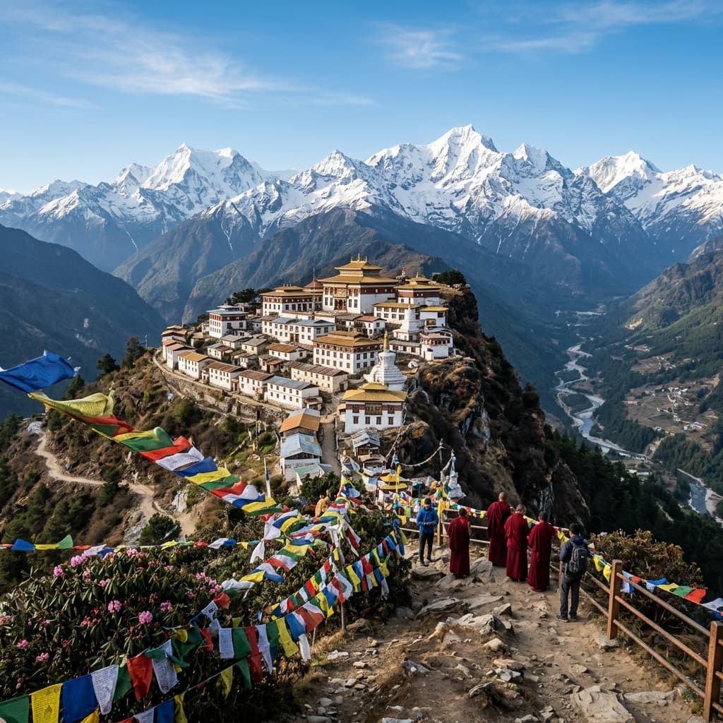
Arunachal Heights & Passes
Tawang & High Mountain Passes
High monasteries & border valleys
The Meghalaya Highlands Circuit
Our flagship six-day route designed to take you deep into the heart of the hills. Experience the raw terrain, pristine rivers, and ancient root architecture.
Acclimatize in the Pine City. Explore the local cafe culture, Ward's Lake, and the Shillong Cathedral Catholic Church.
Drive the Mawkdok Valley bridge. Visit Wei Sawdong triple-tier falls, Nohkalikai, and trek down the 3,000 steps to the Double Decker Living Root Bridge.
Float on the crystal-clear waters of the Umngot River in Shnongpdeng. Camp on the riverbanks and visit Mawlynnong village.
Explore the ancient, tall monoliths of Nartiang and trek down to the quiet, hidden pools of Phe Phe Falls in the Jaintia Hills.
Stand at the edge of the Laitlum Canyons before returning via the Guwahati highway for departure.
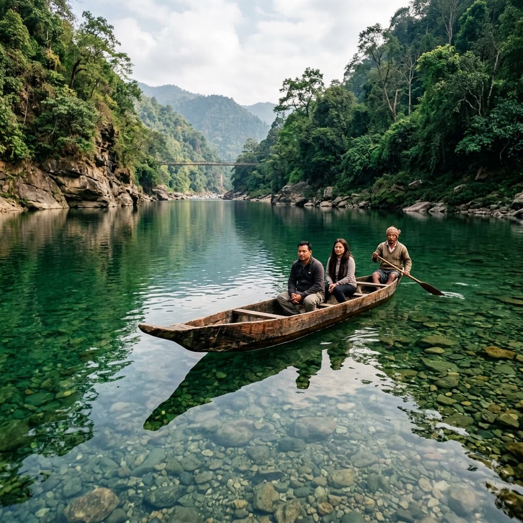
Umngot River, Dawki. The water attains maximum transparency between November and February, where canoes appear to suspend in mid-air above the rock-strewn riverbed.
Grounded in Northeast India
We are not an online booking aggregator or a remote agency. We are on-ground coordinators based in the region, operating with a direct driver network and local village partnerships.
"The difference between a generic tour and an authentic route lies in knowing which village headman to speak with, which road is washed out in July, and where the best local tea stalls are hidden."
Khasi, Jaintia & Garo Hills Familiarity
Navigating the distinct socio-cultural borders of the hills requires respect. We coordinate directly with local village headmen to secure access to community forests and homesteads.
Active Road Networks
Northeast weather changes fast. Our local driver network coordinates real-time road updates via active channels, ensuring we bypass landslips, washouts, and major traffic routes safely.
Direct Logistics Management
No third-party brokers. We directly contract our vehicles, vet our drivers, and coordinate with homestay hosts, giving us complete control over your route quality and safety.
Supporting Local Homestays
We purposefully design itineraries that use family-run village homestays and community guides, ensuring your tourism spend goes directly back to the families hosting you.
Off-the-Beaten-Path Spots
For travelers seeking raw terrain, we highlight remote villages, caves, and canyons that typical tour operators omit from their itineraries.
Krem Chyrpe
Jaintia Hills, Meghalaya
A massive, unlit river cave system. Access involves trekking through local community paddy fields and dense bamboo forests led by local guides.
Loban Falls
Assam-Meghalaya Border
A multi-tiered waterfall hidden deep within the forested buffer zones. Bypassed by commercial routes, it offers quiet stone pools for swimming.
Wahri Chora
East Khasi Hills, Meghalaya
A deep, narrow stone gorge with emerald waters. Accessible only via traditional local wooden canoes navigating between high rock walls.
Siju Cave
Garo Hills, Meghalaya
Also known as the Bat Cave, this ancient limestone system features subterranean streams, deep chambers, and delicate rock formations.
How We Build Your Route
Every itinerary is built from scratch. We plan routes based on active road conditions, seasonal weather, and community homestay availability.
Route Inquiry
Submit details about your group size, travel dates, and interest areas. We start with a direct conversation to understand your expectations.
Draft Route Design
We design a custom route with realistic driving times, specific sightseeing stops, local food recommendations, and verified homestays.
Confirm & Refine
Work directly with our planners to adjust travel times, add off-beat stops (like treks or caving), and finalize the vehicle arrangements.
Travel & Ground Support
We coordinate your local driver, confirm homestays, and maintain direct phone lines for on-ground assistance throughout your trip.
Feedback from the Road
Read notes from travelers who have completed driver-guided routes across Assam, Meghalaya, and Arunachal.
Regional Photo Gallery
A visual compilation of our paths through Assam, Meghalaya, and Arunachal Pradesh. Captured on-site by our guides and travelers, showcasing the raw, unfiltered landscapes of the Northeast.
"No filters, no staging. Just the raw, unedited landscape as it reveals itself to those who travel slowly through the valleys."
Latest from the Blog
Read guides, route advice, and ground updates compiled by our coordinators in Shillong and Guwahati.
A First-Timer's Guide to the Meghalaya Circuit: Shillong to Dawki
An essential roadmap for first-time travelers. Learn about driving timelines, Shillong pine ridges, Sohra cliffs, and Dawki river transits.
Chasing Waterfalls in Cherrapunjee: A Stop-by-Stop Guide
A complete logistics guide to Wei Sawdong, Nohkalikai, Kynrem, and the Double Decker Living Root Bridge hike under active weather conditions.
Beyond the Guidebook: Off-Beat Meghalaya (Krem Chyrpe, Loban Falls & More)
Highlighting lesser-known river caves, hidden canyons, and monolith temples in the Jaintia and Garo Hills.
Frequently Asked Questions
Have questions about route planning, local permits, road safety, or weather conditions in Northeast India? Here are answers to the questions we receive most often.
Our routes include a private vehicle chosen for mountain terrain, a vetted local driver, handpicked regional homestays or hotel stays, all required permit documentation (such as ILPs for Arunachal Pradesh), and 24/7 on-ground coordination.
Yes, all visitors need permits (Inner Line Permits for Indian citizens, Protected Area Permits for foreigners) to enter Arunachal Pradesh. We handle the entire application and documentation process for you as part of our route planning.
Meghalaya's waterfalls are at their peak during the monsoon (June to September). The dry months (October to April) are ideal for trekking, boating on the clear waters of Dawki, and wildlife safaris in Assam's Kaziranga National Park.
Yes, every route is built from scratch. You can customize the day-by-day pace, add day treks, choose homestays over hotels, or adjust the stops to match your travel style.
We work exclusively with a network of vetted local drivers who have navigated the mountain roads of Northeast India for years. For specialized activities like river caving or root bridge treks, we coordinate with local community guides.
Our Operations Coverage
We maintain active road coordination and local guide networks across three key states in Northeast India.
Shillong Operations Center
Coordinating East Khasi, West Khasi, Jaintia, and Garo Hills. Direct contact points in Cherrapunjee and Shnongpdeng for local homestay, boating, and canyoning logistics.
Guwahati Transit Gateway
Our primary logistics hub. Coordinates airport pickups, regional vehicles, wildlife safaris in Kaziranga National Park, and cultural circuits to Majuli River Island.
Tawang Mountain Center
High-altitude logistics management. We coordinate Inner Line Permits (ILP), specialized 4x4 vehicles, and winter route safety for the Sela Pass and the Tawang-Dirang circuits.
Field Data Log
Note: Operations cover the Brahmaputra valley in Assam, the full mountain terrain of Meghalaya, and the high-altitude border districts of Western Arunachal.
Ready to Plan Your Custom Itinerary?
Email us directly with your travel details, or drop us a line. We reply within 24 hours with a draft route design and guide availability.
Majestic Miles Travel
Note: Vetted local driver network and community guide coordination available year-round.